The IMPROVE data for Pb
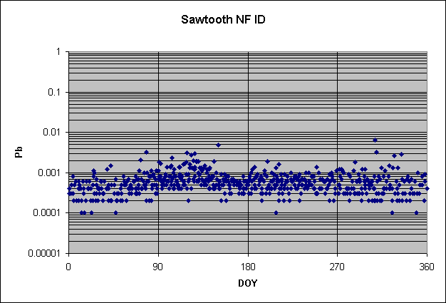
The main message from the set of slides for Pb is that the entire western U.S. is exposed to a pulse of atmospheric Pb each March, April, and May. The lower the local background, the better the pulse is seen. At the peak, the highest highs are 2-3 ng m-3 and the highest lows are 0.5-0.7 ng m-3. A typical pulse is shown in the figure below. for Sawtooth National Forest, Idaho.
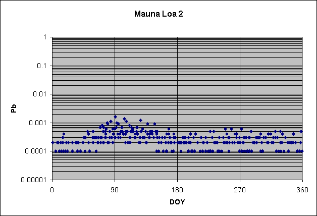
The values of this peak are remarkably consistent across most of the American West. They are also seen in Hawaii, as shown for Mauna Loa below.
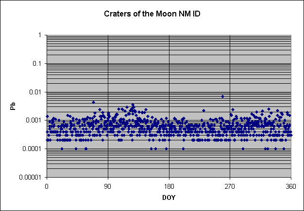
Higher local backgrounds make the peak harder to detect. Here is another site in Idaho, Craters of the Moon National Monument, where the background is higher and the spring peak consequently muddier. Note how the raised minima show the peak as well as the raised maxima.
Once
the Pacific air crosses the Rockies, the pulse is increasingly masked by the higher
local backgrounds of the more-populated areas.
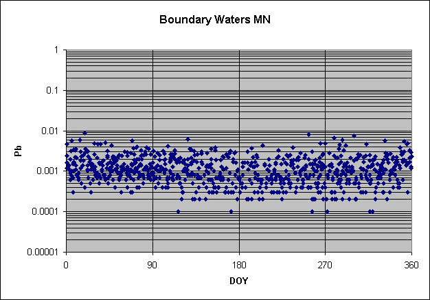
The north central US has higher
Pb in winter, which I believe represents Arctic aerosol coming down over Canada
(shown for Boundary Water, Minnesota, below).
Neither of these transported aerosols represents a health threat, however, as their levels are 1000
times below the American standard. The phenomena are of tutorial value only.
A second major message from these slides is the depression of
Pb in summer throughout the Southeast. This effect can be seen most clearly in
Florida and Georgia (Chassahowitzka, Everglades, and Okefenokee), but also in
Louisiana (Breton) and even over into West Texas (Guadalupe Mts. and Big Bend).
The figure below shows the effect in Okefenokee. Note how it begins abruptly in
early June and lasts through most of September.
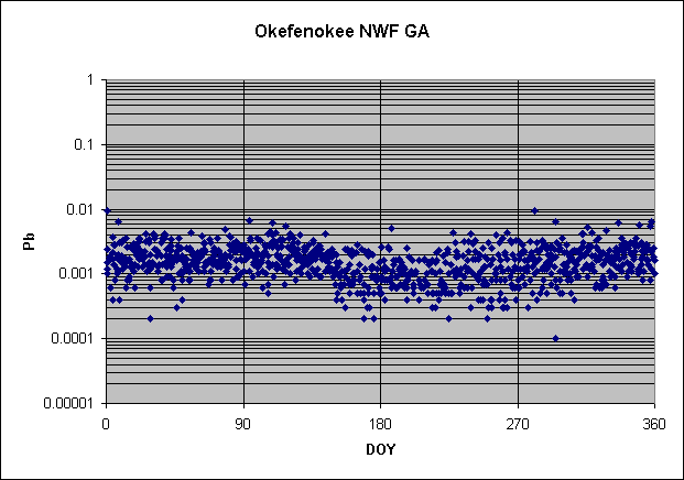
Careful looking reveals that the depression of Pb extends in muted form into New Mexico, Arizona,
and the mid-Atlantic states. It represents a negative effect of clean Atlantic
air that is most noted for bringing Saharan dust to the Southeast. (See
discussions under Si and Ca/Si below.) It is very important to understand that
negative effects can be tracers, too, not just positive effects. The depressed
concentrations, about 1 ng m-3, are similar to those throughout the
summer in the Virgin Islands, which are dominated by the northeasterly trades at
that time and so are upwind of the American Southeast.
One interesting phenomenon revealed by these plots is what I
call "splits," or months or seasons when there are two sets of
concentrations at a site, one high and one low. I am coming to believe that this
happens a lot, although it is seen better in some places than in others.
Needless to say, splits cannot be properly handled by conventional statistical
techniques—you must first view them graphically.
One especially clear example of a split is Pb at Saguaro, Arizona, during late
spring, summer, and into fall, as shown in the figure below.
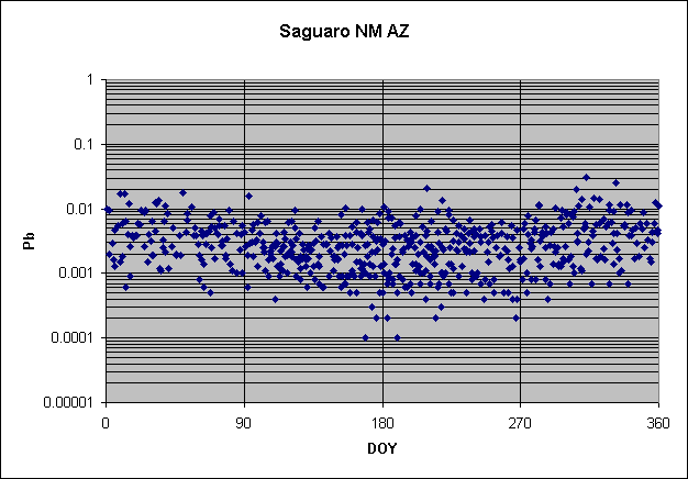
Note the line of concentrations at 3 ng m-3 and the parallel line at 1 ng m-3. The lower line corresponds to Atlantic air; the upper is probably continental. Similar but weaker splits are seen at Guadalupe Mts. and Big Bend, Texas, during roughly the same times. In principle, any site that gets air from two very different directions within a season can be subject to a split in concentrations, especially when those directions represent different types of sources (most typically continental vs. marine or north vs. south).